Map of Ganvie for navigating Lake Nokoue's stilt village: main canals, neighbourhoods, floating market, crafts, accommodation. Visual landmarks and navigation tips.
Ganvie has no streets, no house numbers, no directional signs. Its avenues are canals, its squares are water intersections, its landmarks are centuries-old trees and wooden landing stages. For the visitor arriving from the Abomey-Calavi landing stage, navigating the stilt city can seem disorienting at first. Yet with a few keys to reading it, the map of Ganvie on Lake Nokoue becomes very legible -- and orientation happens naturally, by following the water.
This article gives you the essential landmarks to understand how Ganvie is organised, which neighbourhoods you will pass through depending on your tour, and how to find your way back if you stray from the planned route.
General organisation: reading Ganvie from the lake
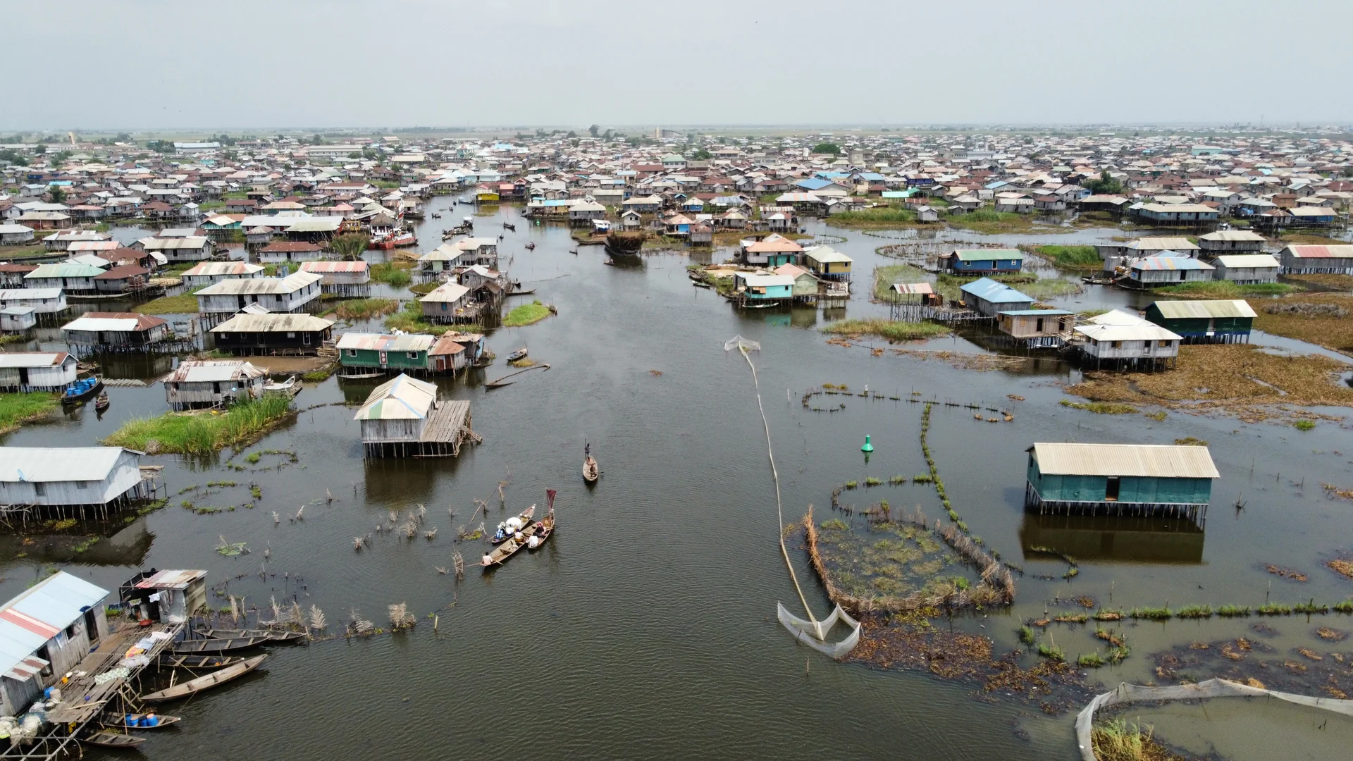
Ganvie is not a uniform village. It is a collection of neighbourhoods called houedje in the Tofinu language, spread over several kilometres along the northern shore of Lake Nokoue. The whole settlement stretches east to west for approximately five kilometres, with a variable depth of 500 metres to two kilometres from the bank.
The basic structure is simple: there is a central axis (the main channel), secondary axes branching from it, and wooden walkways connecting houses where the canals become too narrow for pirogues.
The main channel runs through Ganvie from northwest to centre-east. It is the village's fundamental artery. All pirogues arriving from Abomey-Calavi use it. All tours begin and end along it. Stay on this channel and you will never get lost.
The secondary canals branch off from the main channel into the interior of the neighbourhoods. They are narrower, often shaded by houses that extend over the water. These are the canals that exploration tours take to enter the daily life of the village.
The walkways are wooden planks laid on stilts that connect houses and platforms. Some are wide enough for two people to pass each other. Others are private access paths the width of a single plank.
The main neighbourhoods of Ganvie
Each part of Ganvie has its own logic. What you pass through depends on the duration and type of tour you have chosen.
The central hub and the busy channel
This is the area that nearly all visitors know. It is organised around the central section of the main channel, where the houses are closest together, where movement is most dense. In the morning, supply pirogues circulate in a continuous flow: women leaving to sell at the market, fishermen returning with their catch, children heading to school.
This is also where the small businesses are concentrated -- a grocery run from a moored pirogue, a net repair workshop, a few houses selling cold drinks from the window.
The floating market neighbourhood (Azowlisse)
The floating market is held at the intersection of the main channel and a wide secondary canal, near the geographical centre of Ganvie. Identification is easy: it is the only place on the lake where you will regularly see 30 to 80 pirogues gathered in a tight perimeter, especially between 6:00 and 10:00 AM.
The market is Ganvie's commercial epicentre. Smoked fish, fresh fish, vegetables, condiments, palm oil, fabrics, soap -- everything passes through here. The sellers know their customers of many years. Prices are negotiated in low voices, from the edges of the pirogues, without ever setting foot on dry land.
After 11:00 AM, the market gradually disperses. Sellers return to their neighbourhoods. By 1:00 PM, the intersection is nearly empty.
The eastern residential neighbourhoods: towards So-Ava
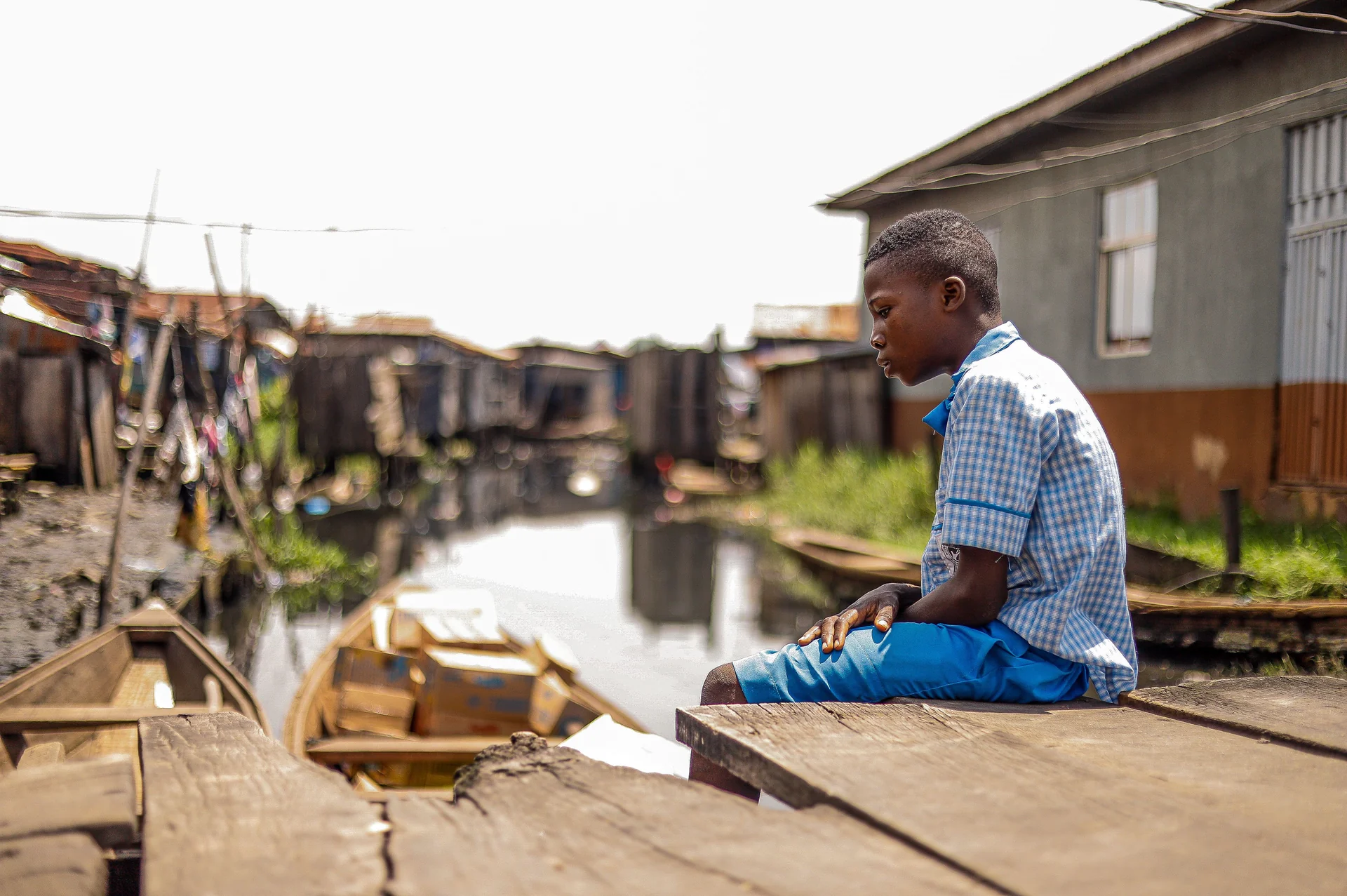
In the direction of So-Ava (the neighbouring village, 20 minutes by pirogue to the east), the urban fabric thins out. Houses are more spaced apart, canals wider, sounds quieter. This is the Ganvie of fishing families who live slightly removed from the central activity.
You will recognise these neighbourhoods by the constant presence of pirogues moored in front of each house -- sometimes two or three, depending on the family size and the number of men who fish. Nets dry on railings, traps await the dawn departure.
This area is less visited by short tours. Exploration tours (3 hours or more) include it and allow you to see Ganvie beyond the most tourist-frequented areas.
The western residential neighbourhoods: the school and artisans
Towards the western landing stage of the village, the urban fabric densifies again. Here you will find several community buildings: the floating school, chapels, and the artisan zone where wood carvers and weavers work.
This neighbourhood is more shaded. Houses are closer together, canals narrower. The morning light diffuses differently here -- making it a particularly interesting area for photographers in the late morning.
The artisan zone
It is grouped in continuity with the western residential neighbourhoods, a few minutes by pirogue from the main channel. The workshops are easily recognisable: wood shavings on the platforms, animal and pirogue silhouettes at various stages of completion, the smell of varnish.
The artisans work in the open air. You can stop, observe, ask questions. A guide will introduce you -- which facilitates conversation and lets you see pieces that are not always put on display for visitors.
Visual landmarks: finding your way without a digital map
In Ganvie, mobile reception is variable. Maps.me with offline tiles can work, but the mapping of secondary canals is incomplete. Orientation therefore relies mainly on visual landmarks.
The great kapok tree. An imposing tree, visible from the main channel, at the edge of the market. It is the best-known meeting point in Ganvie. Residents have used it as a reference for generations. If you wander off and do not know where you are, ask any pirogue to show you "the big tree" -- they will point the way.
The Catholic church. Visible from the main channel, its white facade and corrugated iron roof distinguish it from residential houses. It is built on a slightly raised platform, making it visible from a distance.
The floating school. Larger than the surrounding houses, with a Benin flag visible from afar. It serves as a landmark for the western neighbourhood. If you are looking for the artisan zone, the school is two or three minutes away by pirogue.
The statue of Agbodogbe. On the royal square, a wooden statue represents the legendary founder of Ganvie. It is the symbolic centre of the village, a kind of church square but on the water. It is on the main channel, easily visible from the pirogue.
Community landing stages. Each neighbourhood has a collective landing stage, marked by wooden posts higher than house supports. They constitute the entry points of neighbourhoods from the main channel.
How guides read the lake
Tofinu guides do not use maps. They read the lake as a spatial memory transmitted since childhood -- the position of each house, the name of each family in each canal, the seasonal variations in water level that change the passages.
This intuitive reading of the lake is what makes the accompaniment of a native guide irreplaceable. A guide recruited at the landing stage that same morning knows the main points. A Ganvie guide who grew up in a specific canal of the village will show you corners that standard tours do not visit.
Visit Ganvie tours are led by Tofinu guides registered with the Association of Guides of Abomey-Calavi. They adapt the tour in real time according to market activity, water level, and what is happening on the day of your visit.
Available mapping tools
The sign at the landing stage. At Abomey-Calavi, a sign displays a simplified plan of Ganvie with the main neighbourhoods and major orientations. It is basic but useful for understanding the general structure before you depart. Photograph it.
Maps.me offline. Maps.me with Benin tiles downloaded in advance displays the lake contours and the main canals of Ganvie. The accuracy of secondary canals is insufficient for independent navigation, but the map is enough to get an idea of your position on the lake.
Google Maps. Google Maps satellite coverage of Ganvie is satisfactory. In satellite mode, you can distinguish the main channel, the large clusters of houses, and some secondary canals. The online version works if you have network coverage -- which is variable on the lake. Download the area offline before leaving.
OpenStreetMap. The level of detail varies depending on local contributions. Some streets (canals) are carefully mapped, others are not.
For an independent visit, the best approach remains the combination: satellite imagery as a base (for position), visual landmarks in practice, and a guide if you wish to access the secondary canals and inner residential areas.
How to navigate during your visit: practical rules
Follow the main channel. As long as you stay on the broadest waterway, you cannot get lost. It is your backbone in Ganvie.
Note the position of the sun. Lake Nokoue is oriented roughly north-south. Coming from Abomey-Calavi (which is northwest of Ganvie), you enter heading southeast. In the morning, the sun is on your left going towards Ganvie, on your right on the return.
Memorise two or three landmarks at the entrance. The first thing you see when arriving in Ganvie -- a large tree, a building of a particular colour, the shape of a landing stage -- will become your return point. Keep it in mind.
Ask your guide. Guides know every canal. Do not hesitate to ask them the names of the neighbourhoods you pass through, the names of the families who live in a particular house. These details transform a crossing into understanding.
Ganvie reveals itself more than it can be read on a map. After one hour on site, orientation becomes natural -- you follow the movement of the pirogues, you spot the trees, you listen to the sounds that vary from one neighbourhood to another. It is a form of navigation that cannot be learned from a screen.
Book your visit
Guided tour with native Tofinu guide, private pirogue, fixed prices.
Questions fréquentes
Can you get lost in Ganvie without a guide?
Are there any signposts in Ganvie?
Does Google Maps work in Ganvie?
Do the guided tours cover all of Ganvie's neighbourhoods?
How many houses are there in Ganvie?
Related articles
Ganvié: tourism and visit on Lake Nokoué
Ganvié is Africa's largest stilt village. Between pirogues, floating market, Acadja fishing, and life on stilts, it offers an unforgettable tourism experience on Lake Nokoué. Everything you need to know before your visit.
supportTourist attractions in Benin: complete guide to places to visit
Benin is packed with unique tourist attractions: the stilt city of Ganvié, the Slave Route in Ouidah, the Royal Palaces of Abomey, Porto-Novo, Grand-Popo beaches, and Pendjari National Park. Complete guide with suggested itinerary.