Before becoming the cradle of Ganvie, Lake Nokoue was a vast lagoon system teeming with fish. A look at the geographical origins and unique ecosystem of this exceptional lake.
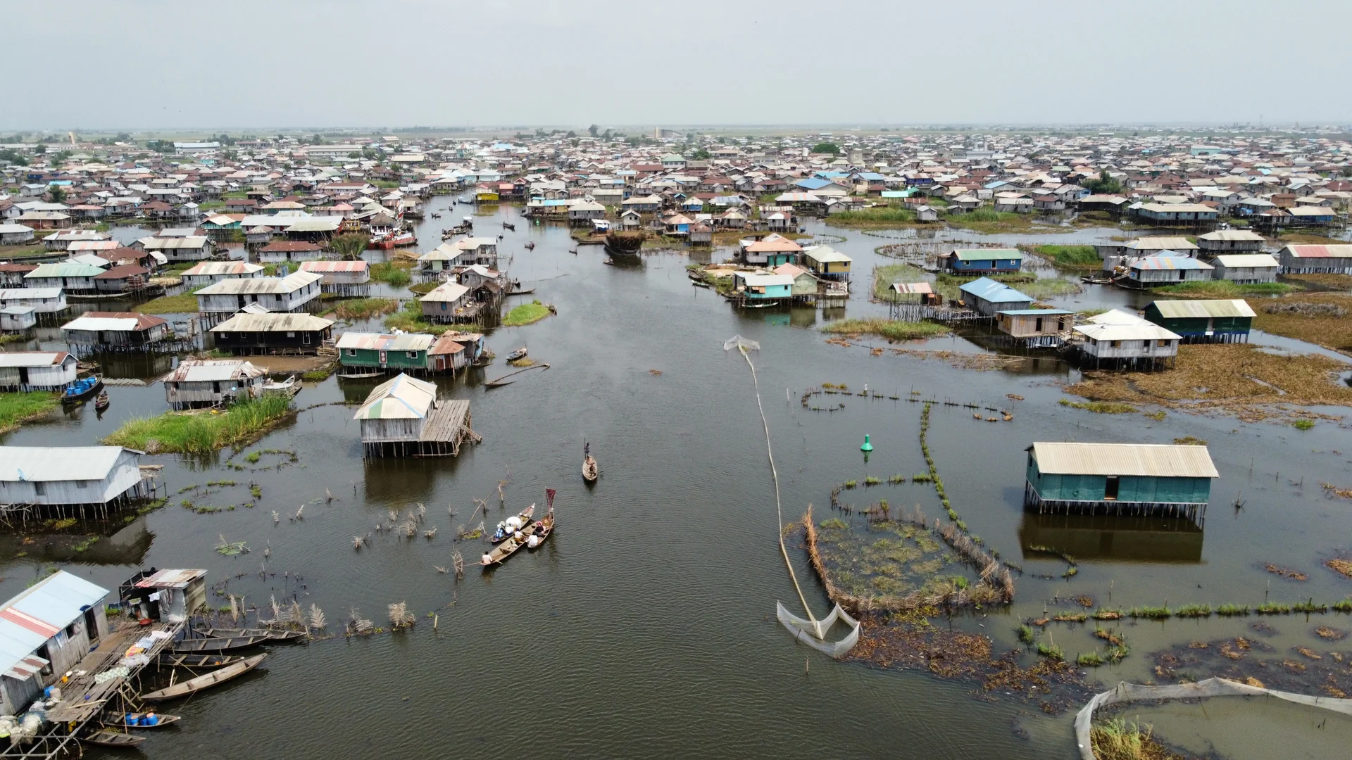
Ganvie was born on the water, but that water existed long before the first Tofinu pirogues came to moor there. Lake Nokoue is not merely a backdrop for travel photographs. It is a 150-square-kilometre ecosystem, a complex lagoon system that connects the Atlantic Ocean to the inland valleys of Benin, and whose geographical particularities made possible the largest stilt village in Africa. To understand Ganvie, you must first understand the lake that carries it.
A lake born from the lagoon: geographical formation
Geologically, Lake Nokoue is not a lake in the classical sense. It is a coastal lagoon, born from the meeting of the fresh waters of the So and Oueme rivers, which descend from the inland plateau, and the salt waters of the Atlantic Ocean. This transition zone, called "Bouche du Roy" by the first French cartographers, is separated from the sea by a thin strip of sand parallel to the coast: the coastal sandbar that today supports the city of Cotonou.
The formation of the lagoon is the result of a long geological process, initiated several millennia ago by variations in sea level during the last glaciation. When the sea retreated, coastal depressions were trapped between the sandbar and the continent. These depressions, fed by the rivers, became the lagoons and coastal lakes that punctuate the entire Gulf of Benin.
Lake Nokoue today communicates with the ocean via the Cotonou channel -- a natural passage that has been widened and regularly dredged since the early 20th century to allow merchant ships to navigate. This link with the sea is fundamental: it regulates the lake's water level, renews its populations of migratory fish, and maintains a chemical balance between fresh and salt water.
Dimensions, depths and seasonal variations
The surface area of Lake Nokoue varies considerably depending on the season, making it a dynamic system difficult to measure with precision since the first colonial maps.
In the dry season (November to March), when the So and Oueme rivers are at their lowest flow, the lake covers approximately 50 to 70 square kilometres. In the rainy season (June to October), floods swell the tributaries and the lake can expand to 150 square kilometres, or even more in years of heavy rainfall. The annual fluctuation is therefore considerable.
The average depth is shallow -- between 1 and 2 metres across most of the lake -- which has two direct consequences. First, the lake warms rapidly under the tropical sun, promoting algal growth and fishery productivity. Second, the shallow areas allow light pirogues to navigate where heavier vessels would run aground, and permit fishermen to plant their Acadja in an accessible lake bed.
The deepest areas (up to 3 metres) are found in the channel connecting to the ocean in the south, and in the ancient submerged river valleys. These deep corridors form the main navigation routes between Abomey-Calavi to the north and Cotonou to the south.
Brackish waters: a particular chemistry
The brackish nature of Lake Nokoue -- neither entirely fresh nor entirely salty -- is its most important chemical characteristic.
Salinity varies depending on position in the lake and the season. It is highest in the southern part, near the ocean channel, and lowest in the north, where freshwater inputs from the rivers are greatest. In the rainy season, dilution by floods makes nearly the entire lake almost fresh. In the dry season, the inflow of marine waters can push salinity higher in certain areas.
This variation in salinity structures the lake's biodiversity. Marine species tolerant of salinity changes (mullets, captain fish, sea shrimp) frequent the saltiest areas. Freshwater species (tilapia, carp) prefer the north of the lake and the river mouths. Some euryhaline species use both environments depending on the season, creating predictable fish movements that Tofinu fishermen have learned to read over generations.
Aquatic flora: richness and threats
Before human settlement on the lake, the banks and shallow areas were colonised by dense aquatic vegetation.
Mangroves -- mainly Rhizophora racemosa and Avicennia germinans -- form mangrove areas in the most sheltered sectors. These stilt-rooted trees perform several critical functions: they stabilise the banks, filter sediments, create shaded areas where fingerlings develop safe from predators, and serve as natural nurseries for dozens of fish species. The mangroves of Lake Nokoue were massively cleared for the urbanisation of Cotonou from the 1970s onward, which has durably weakened the lake's reproductive capacity.
Water hyacinths (Eichhornia crassipes), introduced to Benin in the mid-20th century, have become a major ecological problem. This invasive plant from South America forms dense floating mats that block light, deplete oxygen in the water, and make navigation difficult. Manual removal campaigns are regularly organised at Ganvie.
Native water lilies and submerged plant beds constitute the freshwater vegetation in the northern areas of the lake. These plant beds serve as refuge zones for fingerlings and hunting grounds for aquatic birds.
Lake fauna: fish, birds and reptiles
Lake Nokoue hosts a remarkably diverse fauna for a body of water of its size.
Fish. At least forty species of fish are recorded in Lake Nokoue, around thirty of which are commercially exploited. Tilapia of the genus Sarotherodon dominates catches from the Acadja. The captain fish (Lates niloticus), a larger predator whose flesh is highly prized, is present in the deeper areas. Mullets (Mugil cephalus and related species) are migrants that move between the lake and the sea. Lake shrimp, small in size but concentrated in flavour, constitute an important food and commercial resource for the women resellers of the floating market.
Birds. The lake and its shores host over 150 species of resident and migratory birds. The grey heron (Ardea cinerea) and the little egret (Egretta garzetta) are the most visible from the pirogues. The pied kingfisher (Ceryle rudis) is recognisable by its black-and-white chequered plumage and spectacular vertical dives. In the dry season, ospreys (Pandion haliaetus) migrating from Northern Europe stop over on the shores. The lake is classified as a Ramsar site -- a wetland of international importance.
Reptiles. Nile crocodiles (Crocodylus niloticus) are still present in Lake Nokoue, although their populations declined sharply in the 20th century. In Ganvie, they benefit from cultural protection linked to the founding legend of Agbodogbe -- the king who transformed into a crocodile to carry his people across the water. This cultural prohibition on hunting has allowed more sustainable coexistence than elsewhere.
The first inhabitants of the shores
Before the Tofinu built their first stilt houses, the shores of Lake Nokoue were already occupied by populations of fishermen and farmers. The Goun, the Aizo and the Xwla had been exploiting the lake's resources long before the 17th century.
These first inhabitants lived on dry land, in riverside villages, and used the lake as seasonal fishing territory. They had already developed precise techniques: one-way entrance traps placed in shallow areas, dugout pirogues adapted to muddy bottoms, and trade routes for dried fish to inland markets at Abomey and Ketou.
It is this intimate knowledge of the lake -- accumulated over generations of riverside populations -- that the Tofinu inherited and amplified when they made the decisive conceptual leap: to live not beside the lake, but on the lake.
The lake as refuge: the historical moment
When the raids of the Abomey kingdom intensified in the early 18th century, Lake Nokoue became more than a food resource. It became a frontier.
The armies of Dahomey had a religious prohibition against fighting on water. This rule -- deeply rooted in the kingdom's cosmology -- made the lake impassable for the king's soldiers. Agbodogbe, or his advisers, understood this. Settling on the lake meant placing themselves in the one space the enemy could not penetrate.
The lake also offered everything a community needed to survive: abundant fish, transport routes by pirogue, and a natural defensive position. The decision to settle there was simultaneously military, economic and ecological. To explore this history further, read our article on the Abomey raids and the founding of Ganvie.
The lake today: an equilibrium under pressure
Lake Nokoue faces cumulative pressures that have threatened its ecological balance for several decades.
Urban pollution from Cotonou -- discharge of untreated wastewater, plastic waste, petroleum products released by navigation -- is progressively degrading water quality in the southern part of the lake. Siltation linked to deforestation of the northern watersheds reduces useful depth and alters species circulation patterns.
Rising water levels, accelerated by the effects of climate change on Atlantic sea levels, is the most urgent challenge for Ganvie. The current estimate is a rise of 2 to 4 mm per year, which may seem minimal but over twenty years represents several centimetres of additional water affecting the contact zones where stilts meet the water.
To understand the stakes of this pressure on Ganvie's future, read our dedicated article on Ganvie facing climate change.
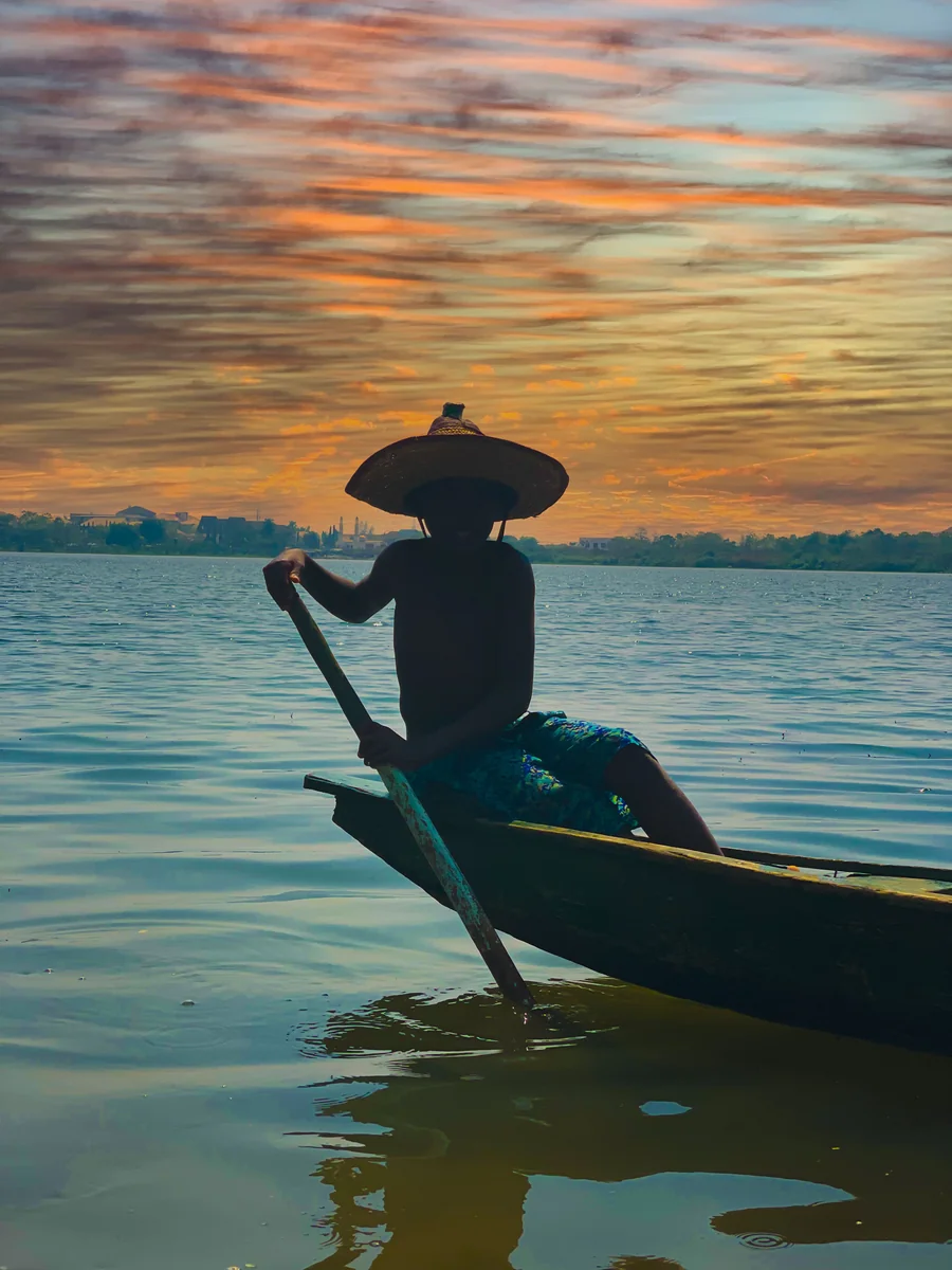
But Lake Nokoue remains above all a place of life, work and beauty. Its waters shine each morning beneath the fishermen's pirogues. The gaze one casts upon it from the stilts of Ganvie reminds us that certain human stories begin with a decision made at the water's edge -- and that the water, sometimes, decides to answer.
Book your visit
Guided tour with native Tofinu guide, private pirogue, fixed prices.
Questions fréquentes
What is the surface area of Lake Nokoue?
Is Lake Nokoue a lake or a lagoon?
What fish species are found in Lake Nokoue?
Is Lake Nokoue classified as a natural heritage site?
Related articles
Tofinu glossary: essential lexicon of lake life
Complete lexicon of Tofinu, Goun and Fon words to understand lake life at Ganvie. Housing, fishing, navigation, spirituality, cuisine: essential vocabulary before your visit.
discoveryGanvié vs other stilt villages around the world
Ganvié, Inle Lake, Nzulezu, Kampong Ayer: four stilt villages from around the world compared. Size, tourism, architecture, access and sustainability.